Our latest blog from Robin Sampson, NAT100 Project Archivist focuses on how one of the most important mapmakers in British history has a link to Norfolk.
William Roy was a key figure in the development of the Ordnance Survey (OS), Great Britain’s national mapping agency (so-named because its original purpose was military; the survey of ‘ordnance’, that is, military supplies and infrastructure including artillery and ammunition). The OS developed from Roy’s ‘Military Survey’ of Scotland in 1747-1755, which came about after English military commanders realised they had no good maps of the Scottish Highlands during the Jacobite Rebellion of 1745. This meant they had severe difficulties locating Jacobite rebel groups, and so a large-scale survey was commissioned to rectify this in any future conflicts. Roy, a Scottish engineer and surveyor, was delegated to undertake the practical work of the survey, and ultimately produced ‘Roy’s Great Map’ of Scotland. The OS, in its better-known incarnation as a producer of topographical maps, ultimately came into being in 1791, less than a year after Roy’s death.
As well as being a notable surveyor and cartographer, Roy was a keen amateur historian and archaeologist, or ‘antiquarian’, as these terms were once known. During his survey of Scotland, he took note of the remains of Roman military camps, and also mapped the Antonine Wall, the furthest point to which the Romans encroached into Scotland. This is where his relevance to East Anglia comes in. In the 1760s he was promoted to surveyor-general and instructed to inspect the coasts of Britain, partly to assess their preparedness for a potential invasion by foreign powers. Once such inspection, in 1776, took him to the Norfolk/Suffolk border, where he visited Burgh Castle Fort (then in Suffolk, but part of Norfolk since 1974). An account of his time there, where he made detailed notes and sketches concerning the ruins, can be found in the Norfolk Record Office under the reference MS 3028, 3D2.
Roy believed the fort, ‘near the junction of the Yare and the Waveney’ to be ‘the Gariononum of the Romans’, one of a chain of late-Roman defensive forts on what was known as the Saxon Shore, whose Count ‘commanded, in order to repel the descents of these invaders (the Saxons) who had already begun to infest the East Coasts of this Island’.
Although he claimed ‘it is utterly impossible to ascertain under what Emperor or by which of the Roman Governors it was originally established’, Roy believed Burgh Castle Fort was one of the ‘last stations [the Romans] occupied in Britain, before the distracted state of the Empire obliged them to totally abandon it.’ He pondered whether the fort was a ‘temporary camp’ converted into a permanent station ‘by strengthening the ramparts and reveting [sic] it with masonry.’


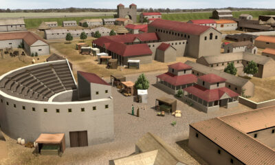
Roy’s detailed notes on Burgh Castle Fort, including sketch plans of the ruins, represent one of the earliest attempts at interpretation of the site. These days, Burgh Castle Fort is managed by the Norfolk Archaeological Trust, and we know quite a bit more about its history, including some finds from archaeological digs there, that you can see at the Norfolk Archaeological Trust: Past, Present and Future exhibition at the Norfolk Record Office, which showcases NAT’s history and runs until 31st May 2024. You can also follow in Roy’s footsteps to explore this historic place, which commands a stunning view over the Breydon Water Estuary – you can really tell why the Romans chose the spot as a defensive site, and why it received Roy’s approval!
Robin Sampson, Project Archivist, The Norfolk Archaeological Trust: Its Centenary and Beyond.
With thanks to project volunteer William Webster for transcribing Roy’s notes.
Sources:
Colonel William Roy, ‘General remarks on Garianonum and the management of the remains; Oct 9th 1776’; Norfolk Record Office, MS 3028, 3D2
‘Roy Military Survey of Scotland, 1747-1755’, National Library of Scotland website
‘William Roy – Military Antiquities of the Romans in North Britain, 1793’, National Library of Scotland website
- A. Gardiner, William Roy, Surveyor and Antiquary, The Geographical Journal vol. 143, No. 3 (November 1977)